Nubra
Capital of Ladakh
General Information
Common Name: Nubra Valley
District: Leh, State: Jammu & Kashmir, India
Area: 0
Languages Spoken: Balti And Ladakhi
Long Distance Code: -
Importance: Altitude is 10,000 ft above sea level
Best Time to Visit: April to July and -
International Access: -
Description
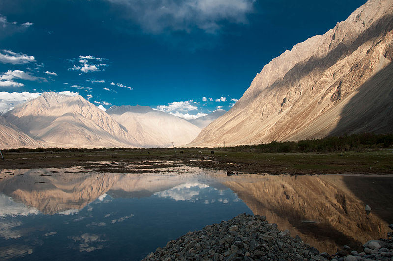
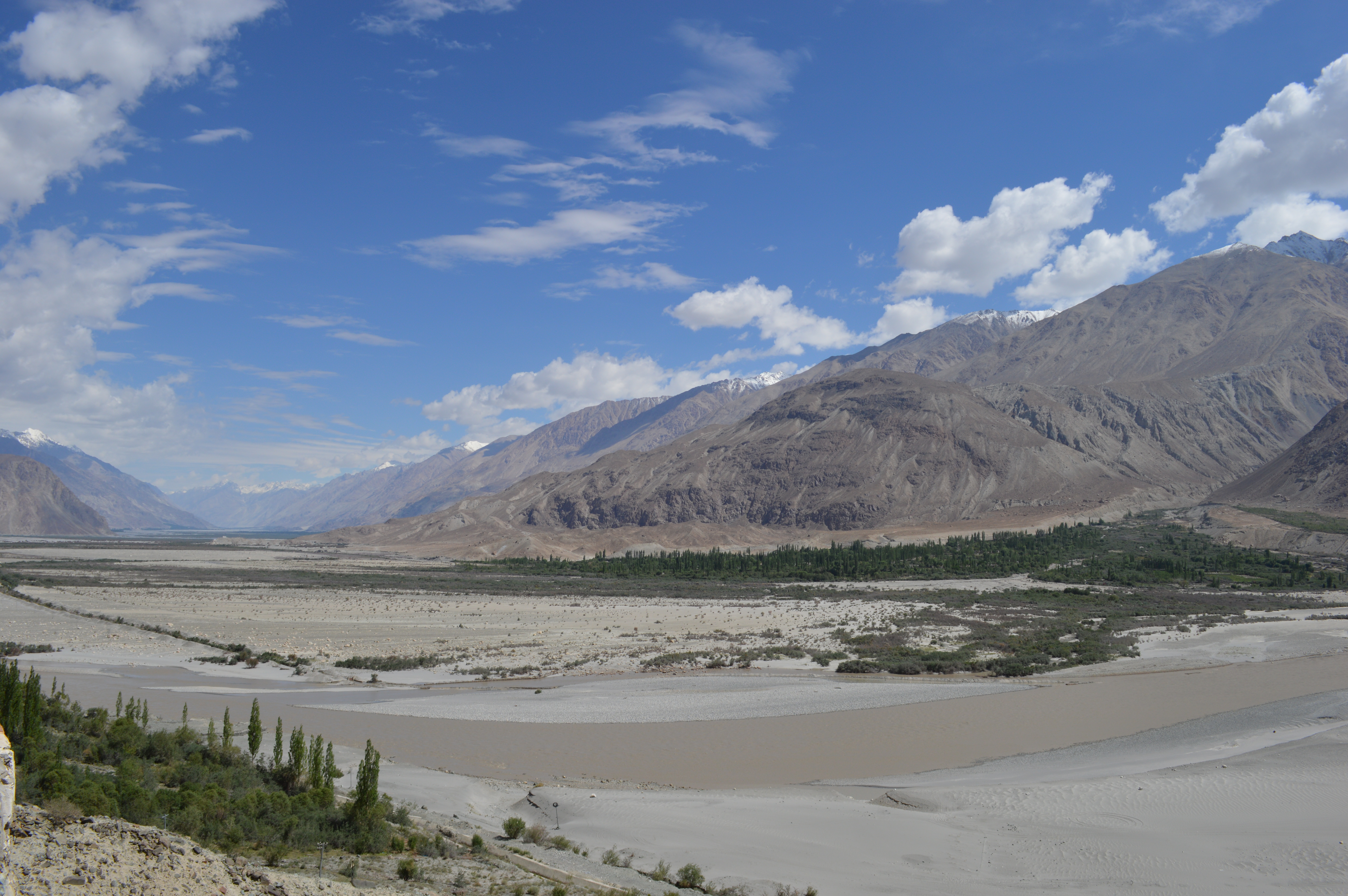
The real name is Ldumra, means Valley of flowers in the local language, Nubra Valley is a high altitude desert with rare precipitation and scant vegetation except along river beds, where irrigated, and on high slopes. The villages are irrigated and fertile, producing wheat, barley, peas, mustard for oil, and a variety of fruits and nuts, including apple, walnut, apricot and even a few almond trees. Nubra was once a major town in the trade route from East to West. Located on the confluence of the Shayok and the Nubra river, which form a Valley. The Bactrian Camel Safari in Nubra is the major attraction to reach this place. The region comprising the valley of the River Nubra and that of the Shayok is the Nubra region. The sand plains in this region are not useful for any kind of vegetation. To reach this place one can drive past the one can drive on the Khardungla Pass, nearly 39 kms from Leh, is the world’s highest motor able road. The Panamik village is the last on this circuit. Once a bustling and prosperous town is today’s sleepy village. Panamik was the last stoppage of the caravans on the silk route. Hence many bazaars were present to cater the need of the travelers. But today hardly anything bustles here, though the Bactrian Camel safari has become a major attraction in this region. The beautiful village of Baigdandu is also located in this area. There is a marked presence of people with startling blue eyes, auburn hair and rosy cheeks as against the typical mongoloid features of the Ladakhis. Local lore has it that they were a Greek tribe who came in search of Jesus Christ's tomb and eventually settled here. Baigdandu is also known for the goats that give you the famous Pashmina shawls.Location
Situated 150 km North of Leh.Climate
Cold Climate throughout the year.

Namgyal Dynasty "Ladakh" / PC-604 (13 Days / 12 Nights)
Delhi-Leh-Uleytokpo-Uleytokpo – Ridzong – Lamayuru – Uleytokpo-Uleytokpo-Leh-Khardongla pass-Nubra (DISKIT & HUNDER)-NUBRA VALLEY-Nubra-Leh-Chumathang – Tsomoriri-Tsomoriri-Korzok-Puga – Tsokar – Tanglangla-Leh-Delhi
Ladakh is a land like no other. Bounded by two of the world's mightiest mountain ranges, the Great Himalaya and the Karakoram, it lies athwart two other, the Ladakh range and the Zanskar range. In geological terms, this is a young land, formed only a few million years ago by the buckling and folding of the earth's crust as the Indian sub-continent pushed with irresistible force against the immovable mass of Asia. Its basic contours, uplifted by these unimaginable tectonic movements, have been modified over the millennia by the opposite process of erosion, sculpted into the form we see today by wind and water. Yes, water! Today, a high -altitude desert, sheltered from the rain-bearing clouds of the Indian monsoon by the barrier of the Great Himalaya, Ladakh was once covered by an extensive lake system, the vestiges of which still exist on its south -east plateau of Rupshu and Chushul - in drainage basins with evocative names like Tso-moriri, Tsokar, and grandest of all, Pangong-tso. Occasionally, some stray monsoon clouds do find their way over the Himalaya, and lately this seems to be happening with increasing frequency. But the main source of water remains the winter snowfall. Drass, Zanskar and the Suru Valley on the Himalaya's northern flank receive heavy snow in winter; this feeds the glaciers whose melt water, carried down by streams, irrigates the fields in summer. For the rest of the region, the snow on the peaks is virtually the only source of water. As the crops grow, the villagers pray not for rain, but for sun to melt the glaciers and liberate their water. Usually their prayers are answered, for the skies are clear and the sun shines for over 300 days in the year. Ladakh lies at altitudes ranging from about 9,000 feet (2750m) at Kargil to 25,170 feet (7,672m) at Saser Kangri in the Karakoram. Thus summer temperatures rarely exceed about 27 degree celcius in the shade, while in winter they may plummet to minus 20 degree Celsius even in Leh. Surprisingly, though, the thin air makes the heat of the sun even more intense than at lower altitudes; it is said that only in Ladakh can a man sitting in the sun with his feet in the shade suffer from sunstroke and frostbite at the same time!
Detailed Itinerary
Day 1 : Delhi-Leh
Day 2 : Leh
Day 3 : Leh-Uleytokpo
Day 4 : Uleytokpo – Ridzong – Lamayuru – Uleytokpo
Day 5 : Uleytokpo-Leh
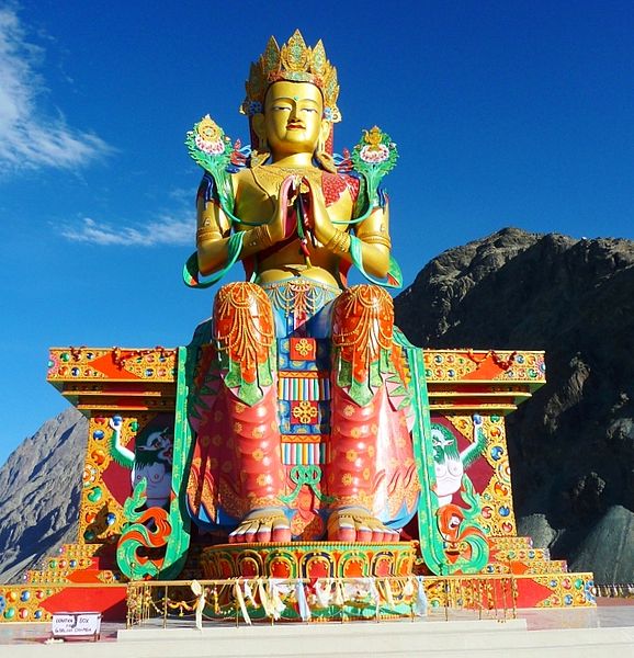
Day 6 : Leh-Khardongla pass-Nubra (DISKIT & HUNDER)
Day 7 : NUBRA VALLEY
Day 8 : Nubra-Leh
Day 9 : Leh-Chumathang – Tsomoriri
Day 10 : Tsomoriri
Day 11 : Korzok-Puga – Tsokar – Tanglangla-Leh
Day 12 : Leh
Day 13 : Leh-Delhi
Delhi-Leh-Uleytokpo-Uleytokpo – Ridzong – Lamayuru – Uleytokpo-Uleytokpo-Leh-Khardongla pass-Nubra (DISKIT & HUNDER)-NUBRA VALLEY-Nubra-Leh-Chumathang – Tsomoriri-Tsomoriri-Korzok-Puga – Tsokar – Tanglangla-Leh-Delhi
Ladakh is a land like no other. Bounded by two of the world's mightiest mountain ranges, the Great Himalaya and the Karakoram, it lies athwart two other, the Ladakh range and the Zanskar range. In geological terms, this is a young land, formed only a few million years ago by the buckling and folding of the earth's crust as the Indian sub-continent pushed with irresistible force against the immovable mass of Asia. Its basic contours, uplifted by these unimaginable tectonic movements, have been modified over the millennia by the opposite process of erosion, sculpted into the form we see today by wind and water. Yes, water! Today, a high -altitude desert, sheltered from the rain-bearing clouds of the Indian monsoon by the barrier of the Great Himalaya, Ladakh was once covered by an extensive lake system, the vestiges of which still exist on its south -east plateau of Rupshu and Chushul - in drainage basins with evocative names like Tso-moriri, Tsokar, and grandest of all, Pangong-tso. Occasionally, some stray monsoon clouds do find their way over the Himalaya, and lately this seems to be happening with increasing frequency. But the main source of water remains the winter snowfall. Drass, Zanskar and the Suru Valley on the Himalaya's northern flank receive heavy snow in winter; this feeds the glaciers whose melt water, carried down by streams, irrigates the fields in summer. For the rest of the region, the snow on the peaks is virtually the only source of water. As the crops grow, the villagers pray not for rain, but for sun to melt the glaciers and liberate their water. Usually their prayers are answered, for the skies are clear and the sun shines for over 300 days in the year. Ladakh lies at altitudes ranging from about 9,000 feet (2750m) at Kargil to 25,170 feet (7,672m) at Saser Kangri in the Karakoram. Thus summer temperatures rarely exceed about 27 degree celcius in the shade, while in winter they may plummet to minus 20 degree Celsius even in Leh. Surprisingly, though, the thin air makes the heat of the sun even more intense than at lower altitudes; it is said that only in Ladakh can a man sitting in the sun with his feet in the shade suffer from sunstroke and frostbite at the same time!
Detailed Itinerary
Day 1 : Delhi-Leh
Day 2 : Leh
Day 3 : Leh-Uleytokpo
Day 4 : Uleytokpo – Ridzong – Lamayuru – Uleytokpo
Day 5 : Uleytokpo-Leh
Day 6 : Leh-Khardongla pass-Nubra (DISKIT & HUNDER)
Day 7 : NUBRA VALLEY
Day 8 : Nubra-Leh
Day 9 : Leh-Chumathang – Tsomoriri
Day 10 : Tsomoriri
Day 11 : Korzok-Puga – Tsokar – Tanglangla-Leh
Day 12 : Leh
Day 13 : Leh-Delhi
Nubra, India Tours