Nalgonda

General Information
District: Nalgonda, State: Andhra Pradesh, India
Area: 0
Languages Spoken: Telgu
Long Distance Code: +91-8682
Importance:
Best Time to Visit: October to March
Description
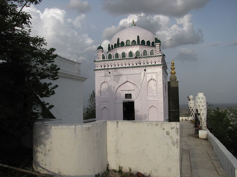
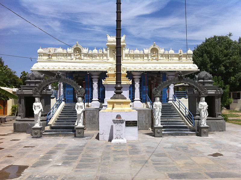
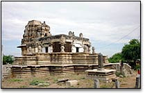
Nalagonda located between two hills, is the headquarters of the district. On the northern hill stands Shah Latif's tomb and on the southern hill there is a strong fort built by the Kakatiya Kings. This place has much historical importance. It has many monuments, forts and temples, which have survived the ravages of time and human vandalism, proclaiming the glorious past of the place. Kakatiya, Satavahana, and Mughals ruled it.<br />It was formerly known as Nilagiri (blue hill) but subsequently came to be known as Nalgonda after its conquest by Ala-ud-Din Bahman Shah. Tourists having a quest to know about the architecture can visit this place as the Kakatiyas constructed many temples here, which are renowned for their architectural beauty. Of these few, the shrines of 'Pachchala Someswaraswami', 'Chhaya Someswaraswami' and 'Chennakesavaswami' are some the most important temples.<br />Location
103-km From Hyderabad
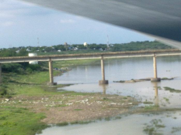
 It is 24.14-kms from Miryalalguda. It is at the confluence of Musi and Krishna. Boatmen trying across the Krishna lived here and so it is called "Vadapalli".
This place is at a distance of 10-km from Huzurnagar, which is famous for Shri Shambulingeshwara temple built by Kakatiya Kings.
 At a distance of 2.41-km from Nalgonda, there is a place called Panugal, which is historically important. It is said that a branch of the Kadamba dynasty ruled Panugal as their capital till the Chalukyas King Kirttivarma conquered them. Panugal is also famous for its brass vessel industry.
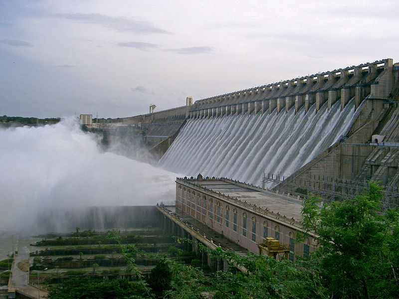
 Nagarjuna Sagar dam is the tallest masonry dam in the World, located on the border of Guntur - Nalgonda districts. The dam was completed in 1966 and it is 124m high and 1-km long. It is built across the river Krishna and has one of the largest networks of canal systems irrigating over 2,000,000 acres of land in Guntur, Prakasam, Nalgonda, Khammam and Krishna districts.
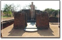
 Nandikonda is a small village on the bank of River Krishna. It is about 64.37-km from Miryalaguda. The most important structure discovered was the Ikshvaku citadel with its great fortification wall, ditch, gates and army barracks inside and a great rectangular stadium.
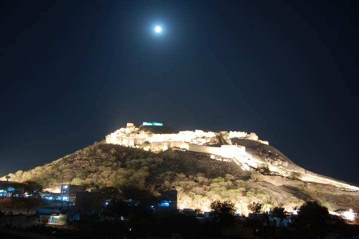
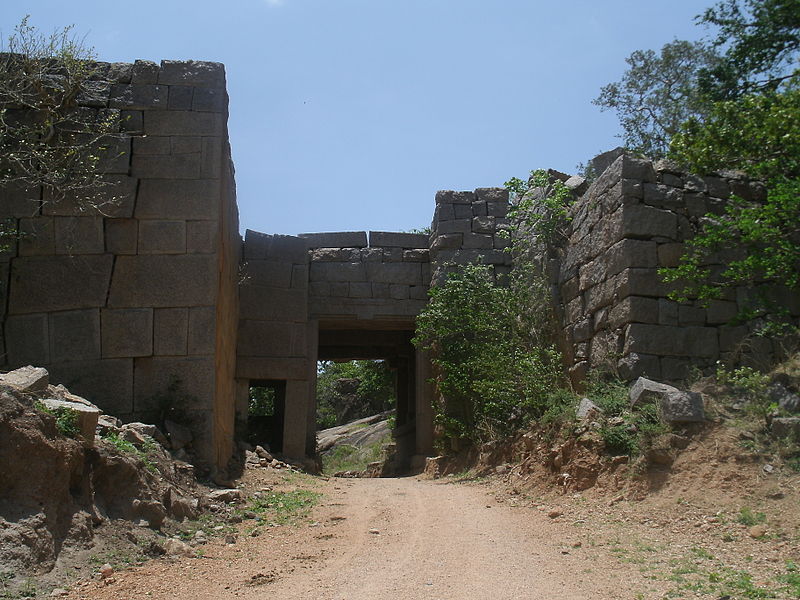
 Bhongir fort is located in Bhongir Taluk of Nalgonda district and is 51-km away from Hyderabad. It was constructed in the shape of an egg on a humongous single rock formation on the hill of Bhongir, 609.6m above sea level, spreading over 40 acres of area.
 It is located 6-km from Aler and 80-km from Hyderabad, and is a place of much historical importance. It was once a prosperous city covering an area of 93.24-kms and the ruins of old fortifications can still be seen. It gained prominence when it was made the alternate capital of the Kalyani Chalukyas in the 11th century AD.
It is at a distance of 9.66-km from Bibinagar and 14.48-km from Bhongir. Acharya Vinoba Bhave started Bhodan Movement here in 1950.
 Beautiful paintings, exquisitely carved pillars and several ancient inscriptions may be seen in the Kakatiyas temples here. This historic was the birthplace of the famous Telugu poet Pillalamarri Pina Veerabhadrudu.
 Situated 64-km from Nalgonda it is a place of tourist importance. The 'Dasavatara' sculptures in a cave near Pattabhigutta and the five temples in the town are excellent specimens of Kakatiya art and architecture. Situated among hill ranges, Rachakonda is a place of considerable archaeological interest.
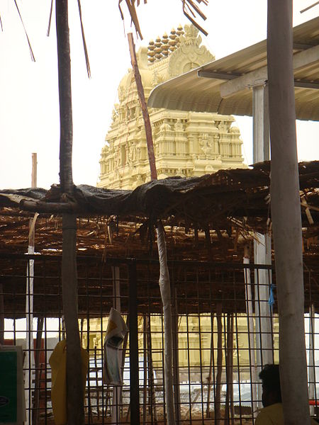
 The famous Shrine of Sri Lakshmi Narasimhaswami stands on the Yadagirigutta hill, in Nalgonda district, about 64-km from Hyderabad. The temple is situated at the top of the hill, which is about 300ft in height. At the foot of the hill, there is a gateway with Gopuram, which is called popularly as "Vaikunta Dwaram".
It is 9.66-km from Huzuranagar and 67.50-km from Khammam. Muktyala is at 19.31-km from here. The Swayam Sambhulingeswara Swami Temple is well known here and it is built by Kakatiyas. The Linga is white and 1.83m height. Its radius is 0.34m. Local people believe that the Linga grows here. For every 0.305m growth, one line is drawn and six lines are marked with vermilion.
Ethipothala Falls is a 70 feet (21 m) high river cascade, situated in shared districts of Nalgonda district, Telangana and Guntur district, Andhra Pradesh India. Located on the Chandravanka river, a tributary of the River Krishna. The waterfall is a combination of three streams namely Chandravanka Vagu, Nakkala Vagu and Tummala Vagu. It is situated about 11 kilometres (6.8 mi) from Nagarjuna Sagar Dam
Timings: 0900 HRS - 1900 HRS
Timings: 0900 HRS - 1900 HRS
Boats have a special significance in Indian mythology, my earliest memory of a boat is watching Ramleela (Ramayana played as stage play, with a boatmen taking Lord Ram across the river. For some reason boats were not available to launch an attack on Lanka, so the Vanar sena ( army of apes) had to build a bridge over the sea. Or may be just may be Lord Ram did not wanted to take chances with all those Vanars on the boat . Please read my account of taking a boat to Nagarjunakonda Island you will understand why Lord Ram chose a bridge over a boat ride to Lanka
Closed On: Friday
Timings: 0900HRS - 1500HRS
Closed On: Friday
Timings: 0900HRS - 1500HRS